Day 2, 9th September, 2012
Srinagar > Sonamarg > Zoji La > Drass > Kargil > Mulbek > Namika La > Fotu La > Lamayuru (316 KM)
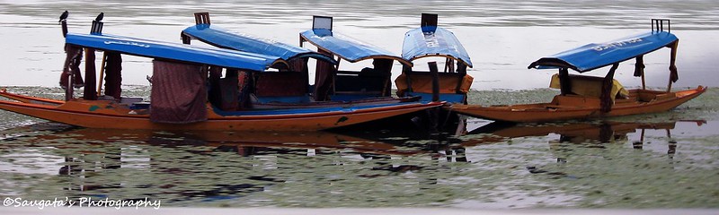
Leaving the Dal Lake Behind
The first thing we came to know when we woke up next morning was that it has been raining since yesternight. The good part was that the rain had transformed itself into light but steady and monotonous drizzle. Rigzin arranged one of his fellow drivers, Sonam, to dispatch us safely from Srinagar to Leh. We were really touched by the way Rigzin handled all the communication with a sense of responsibility that is missing from many so-called sensible fellows – this was the beginning of the Ladakhi hospitality that we would encounter over the next few days.
Sonam arrived sharp at 6.30 am as he promised the earlier evening over phone. In fact it was us who delayed the journey by 15 mins, as we honestly did not expect him to arrive on time!
We were on the Srinagar-Leh highway in no time with the Dal Lake as our companion. We expected to soak in the beauty the Dal Lake under the sun, but it was not to be. Instead it felt to be in an atmosphere which could aptly be used for mourning. The sky was still under the cover of blackish clouds and the drizzle was on which blurred the view somewhat, so even for Photography the exposure was not proper.


Sonamarg
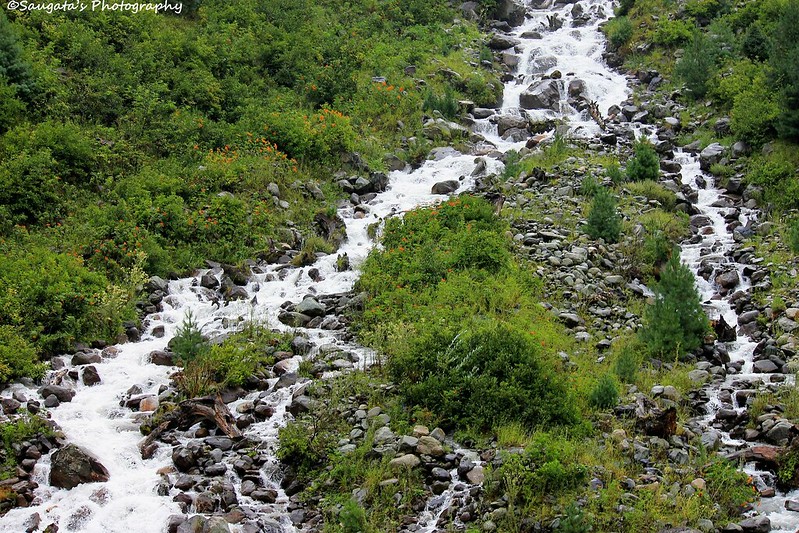
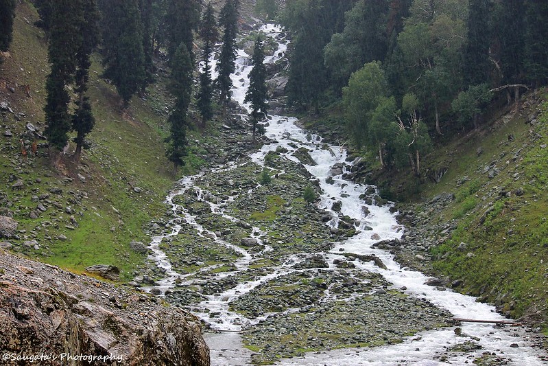
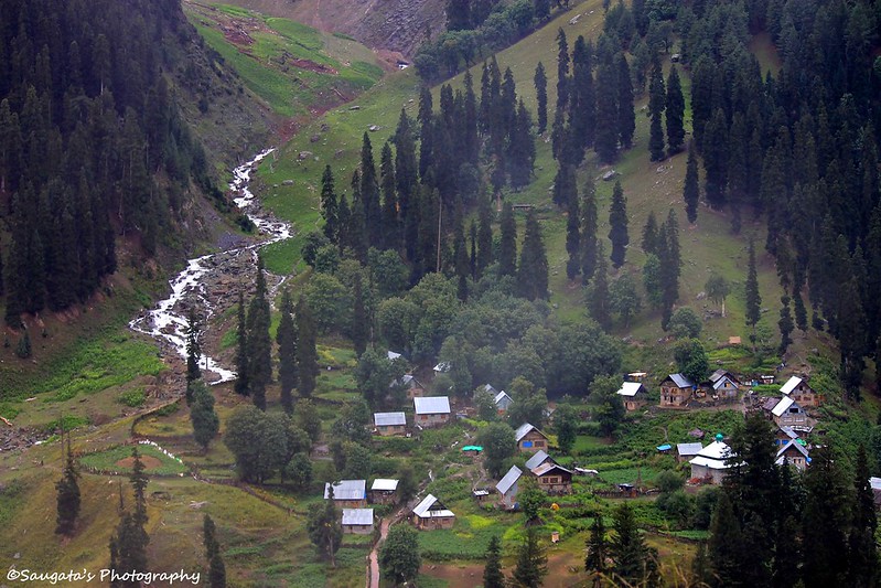
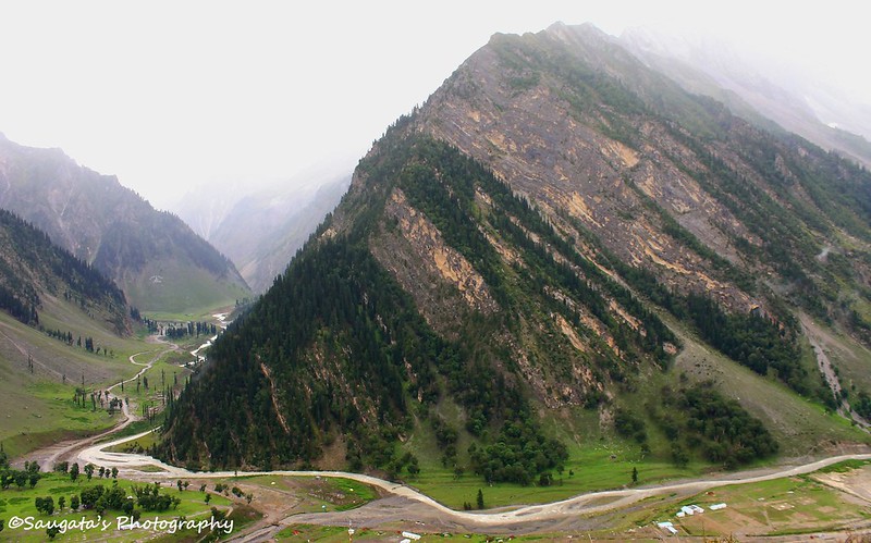
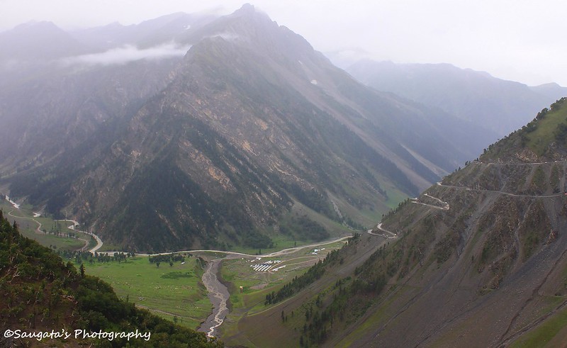
Dal Lake faded into the background after some time. And the magnificent vistas which Kashmir is famous for started to open up, as we approached Sonamarg – meaning the ‘meadows of gold’ – which is 85 kms from Srinagar. Greenery and white linings as waterfalls of various sizes went hand in hand. In normal days, it would have been some picture perfect combination for photography enthusiasts, but weather played a big spoilsport here with its droning downpour. We saw the Thejwas glacier from a distance but for the metrological reasons, no photos.
We had to skip our initial plan to spend a few moments at Sonamarg, unfortunately.
Zoji La
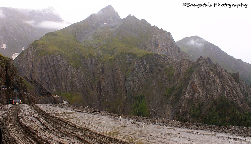
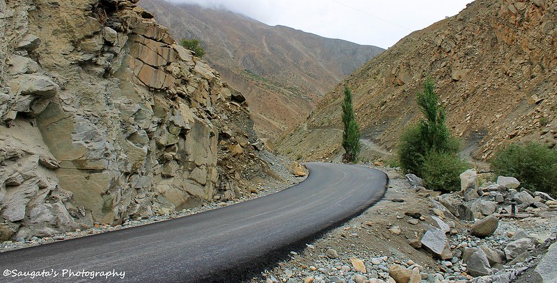
Once we crossed Sonamarg, the ascent to the (in) famous mountain pass – Zoji La (‘La’ means ‘Mountain Pass’ in Ladakhi – started. Zoji La is the first of the 3 mountain passes one would have to cross on the Srinagar – Leh highway, and it is the most difficult of them all because of its notorious fame of being unpredictable during the monsoon.
The greenery began to disappear gradually and barren rugged mountains took its place. Waterfalls became scarcer and the supremely laid tarmac was replaced by an earthen road, full of slush and mud. A lot of wheel spin fun was encountered; sometimes the fun element was much less than fear. The relentless rain did not help to lighten up the spirits either.
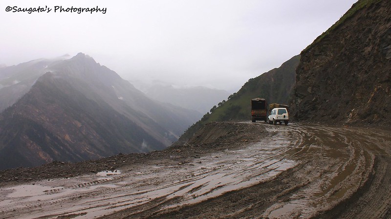
The final ascent to the pass was an arduous one, not only because of the condition of the road (if we can call it that) but also because of the series of trucks and heavy vehicles. Zoji La traffic is controlled by the Indian Army, so it is advisable to cross the same, which we did, before the Army convoy starts from the opposite direction.
Without much fuss, we crossed Zoji La and entered the Ladakh region around 10.30 in the morning.
 |
| Towards Zoji La |
 |
| Crossing Zoji La |
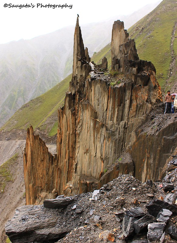 |
| Rock formation |
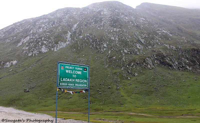 |
| Zoji La crossed - The commencement of Ladakh Region |
Drass
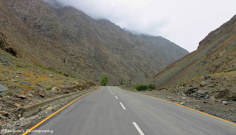
The road started improving somewhat after Zoji La, and we saw the Army convoys moving to the opposite direction while we were on our way to Drass. We were fortunate that we didn’t have to face them while ascending to or crossing the Zoji La.
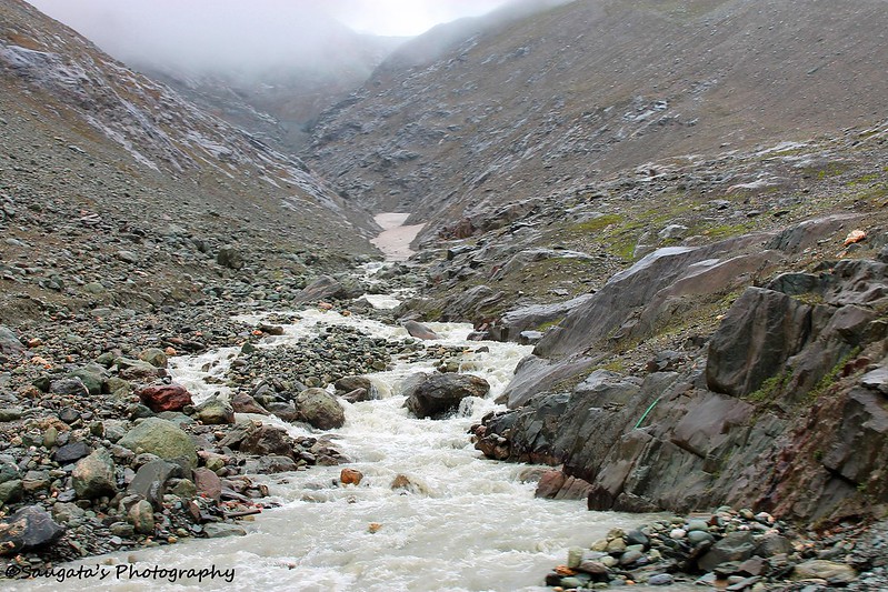
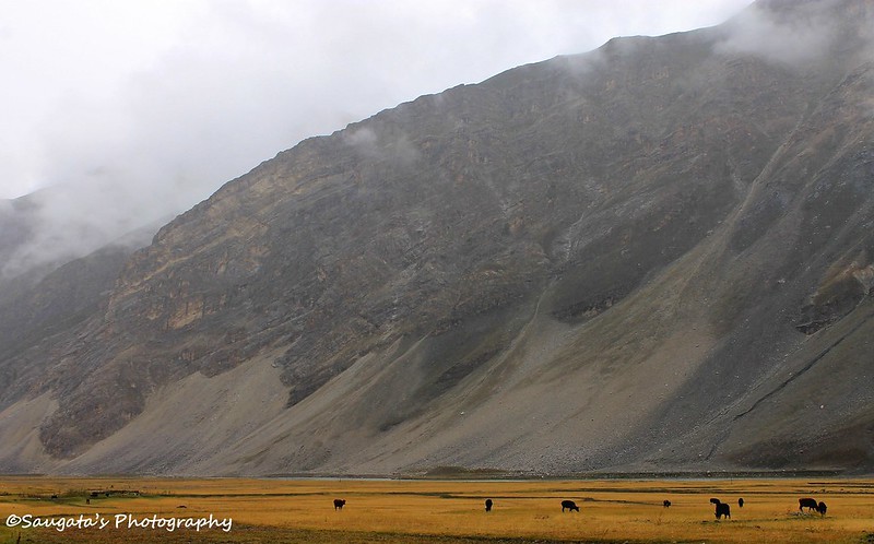
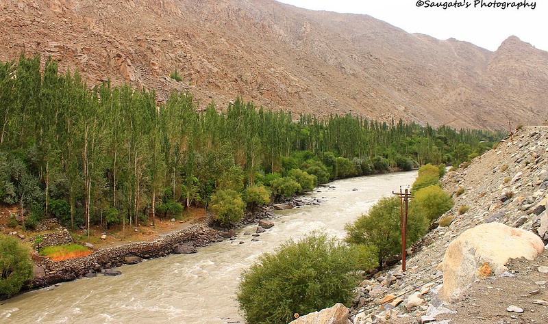
The rain subdued itself a bit so the visibility and our moods both improved and we started clicking infinite number of photos of anything and everything. The vistas around us were completely different from what we have seen in the past – our definition of a hill station was changing. Only thing remained constant was the Suru River which, as a huge serpent, was moving towards us.
We saw the diversion towards Mushko Valley, Tololing and Tiger Hill which our Army re-captured from the opponents after hard-fought, bloody and merciless battle – even as a civilian you are bound to feel the pride and the thrill. We saw some of the enemy bunkers which still existed. Besides the left side of the road a huge stone wall stood to announce its existence as a protection from the firing during the night from those bunkers.
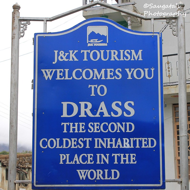
Though Drass was in the headlines in 1999 during the Indo-Pak war, it really has anything to offer to the tourists actually. But it is said to be the ‘Second Coldest Inhabited Place on Earth’ which is amazing. The temperature, in extreme winters, sometime goes as close as to -50C!!!
We had our breakfast in Drass around 11.45 in the morning and wasting not much time, proceeded to our next major halt at Kargil.
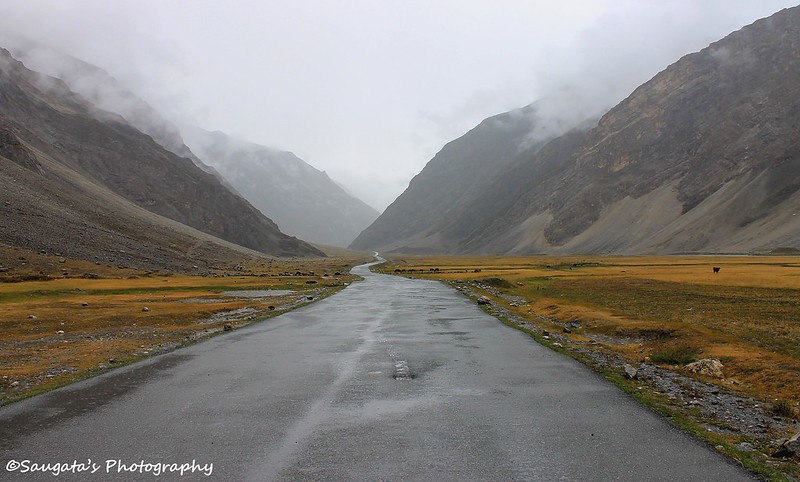 |
| The road ahead |


 |
| Drass Town |
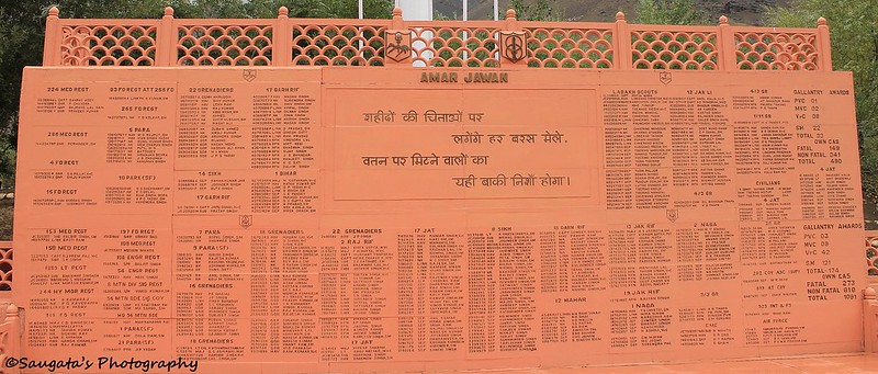
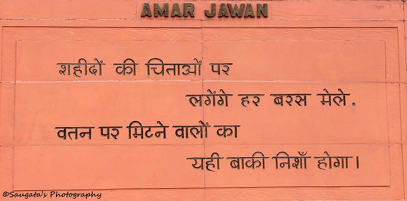
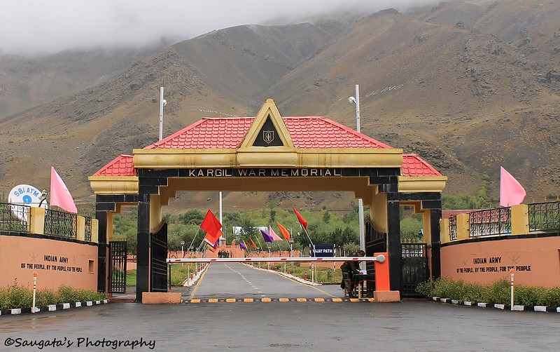
The 1999 War Memorial, the Pride of India
A few Kms from Drass town stands the Kargil War Memorial which is a must-see for all travellers. This memorial was erected to celebrate the hard-earned victory achieved through ‘Operation Vijay’ during the ’99 battle. The names of all the martyrs who gave their lives for our tomorrow are inscribed on the memorial. The waving national flag with the aptly placed Tololing range as the backdrop would boost the morale of anyone. Certainly that was a moment of pride for us. A Salute to Indian Army!!


Kargil
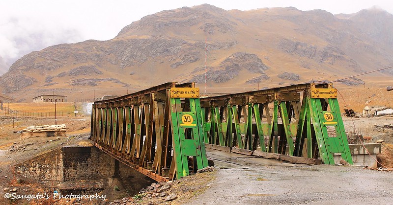
From the memorial, towards Kargil it was mostly a stretch of fantastic smooth roads to drive on with a few real bad stretches, through the never-ending Ladakh landscapes. The Suru River would go to Kargil with us as we were advised by Sonam ji. The greenery on both the banks of Suru was some welcome break from the desertscapes.
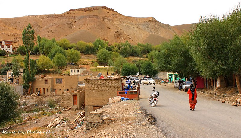
Kargil was the administrative head of the region and our intended stop for the night. I was all excited as we approached Kargil since I have read and watched so many things about this place during the ’99 war. But again, apart from being the headquarters and the desired break for the travellers, the town had very little to offer.
We reached Kargil at around 2 pm, Sonamji advised us to move to Lamayuru instead of staying at Kargil. Thus we could save a day which we could adjust later. His proposal made sense but we were worried about the acclimatization part, but he advised us to decide upon reaching Mulbek – if we start feeling the altitude effect at Mulbek we would stay at Mulbek or come back to Kargil.
So we headed towards Mulbek. On our way we saw the deserted shops and building which were ruined by the shelling in 1999. Many small huts bore the marks of bullets on their walls to remind us that the war was bloodily true enough.


 |
| Accidents do happen frequently |

 |
| Kargil Town |
Mulbek
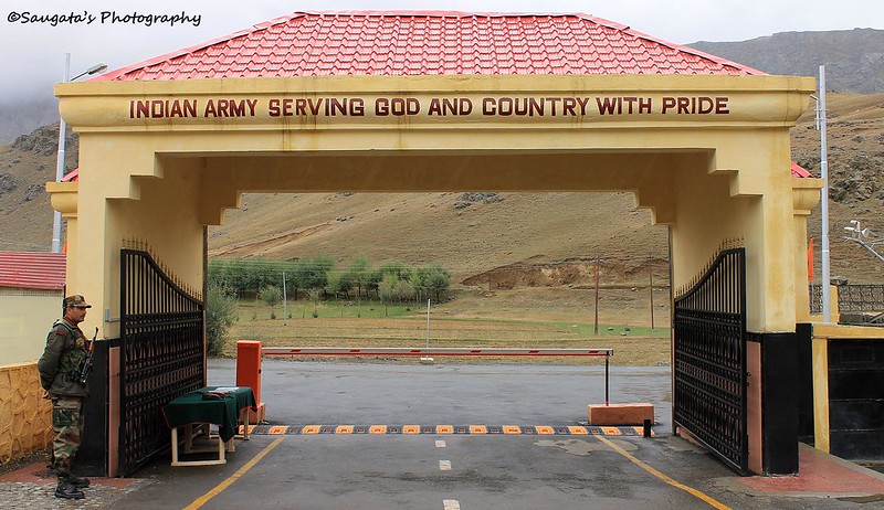
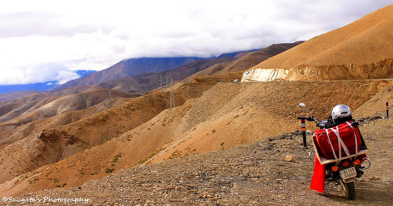
Mulbek was just 40 kms from Kargil but the road was in a mess with lots of ongoing maintenance. As it was not enough, we were delayed by the Army Convoys too. One thing one must note is the heavy army presence through this highway, for obvious reasons.
The surrounding became more and more barren and rugged. Greeneries were available just in patches at a few places and the absence of Suru River made the ambience more arid that it may really be. But the best part is that the rain stopped completely, but the sky was still wearing the blanket of the cloud.
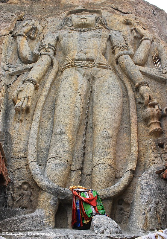
On the way to Mulbek, there stood the Buddha statue, the Maitreya (or the Buddha of the Future). Built in around 7th or 8th century BC from a single rock, the statue is still almost intact reminding us about the height our architecture achieved in ancient days.
We arrived at the sleepy town of Mulbek around 3 pm, starved. The world seemed cruelly prosaic with hunger. So when we were served with fresh hot rice and lentils, the food disappeared in no time! After gathering some strength we roamed around the small village for 5 mins to stretch our legs till Sonam ji refilled his car’s fuel tank.

 |
| Maitreya, the future Buddha |


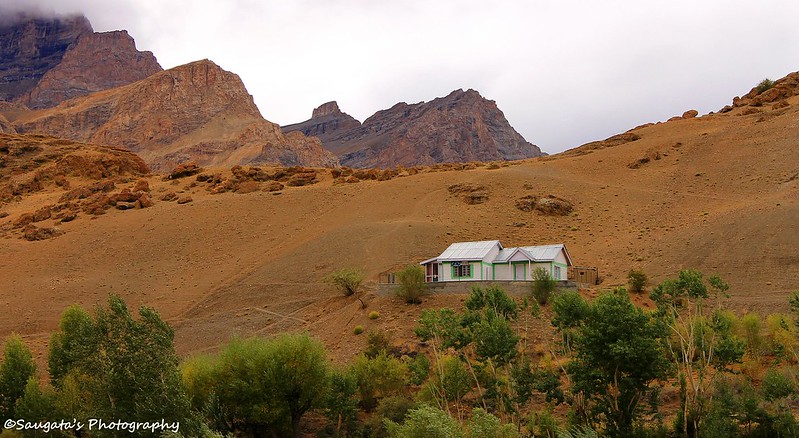 |
| JKTDC Bungalow Mulbek |
 |
| The sleepy town of Mulbek |
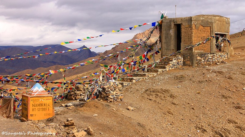
Namika La
Immediately after departing from Mulbek, the ascent started for the second mountain pass called Namika La. The scenery outside was out-of-the-world. We never saw mountains which looked like to be made of sand and soil and absolutely no greeneries!
I felt a little breathless when we reached at the Namika La top, so Sonamji, as experienced as he was, advised me not to exert myself at all and take it easy as we have ample amount of time in our hands to reach Lamayuru.
From the top the landscapes at both the sides were astounding but I was happiest when I saw a small shade of blue above – the sky was indeed getting clearer. I felt I could jump in joy but controlled myself for the better.

 |
| Namika La top |
 |
| From Namika La |
 |
| The first shade of blue sky |
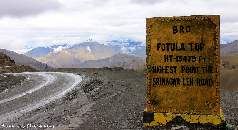
Fotu La
From Namika La, another (and final for the journey) ascent began for the highest point on the Srinagar-Leh road and the 3rd mountain pass, Fotu La. The road was in a mess with slush, but nowhere comparable with ascent to Zoji La.
Apart from the bad road, the ascent was relatively easy towards Fotu La. The top was quite windy to stand, but the Prasar Bharti tower did it easily.
It was again getting darker and as we were tired too, we did not spend much time at the top apart for a few photographs and ventured towards Lamayuru.
 |
| Fotu La Prasar Bharti |
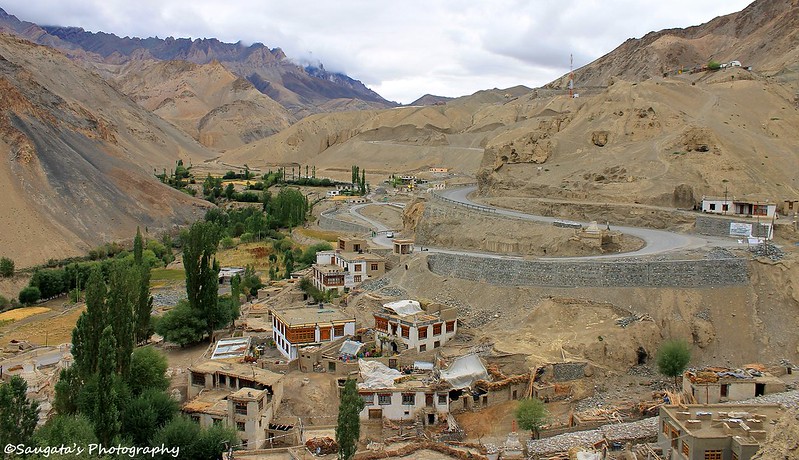
Lamayuru
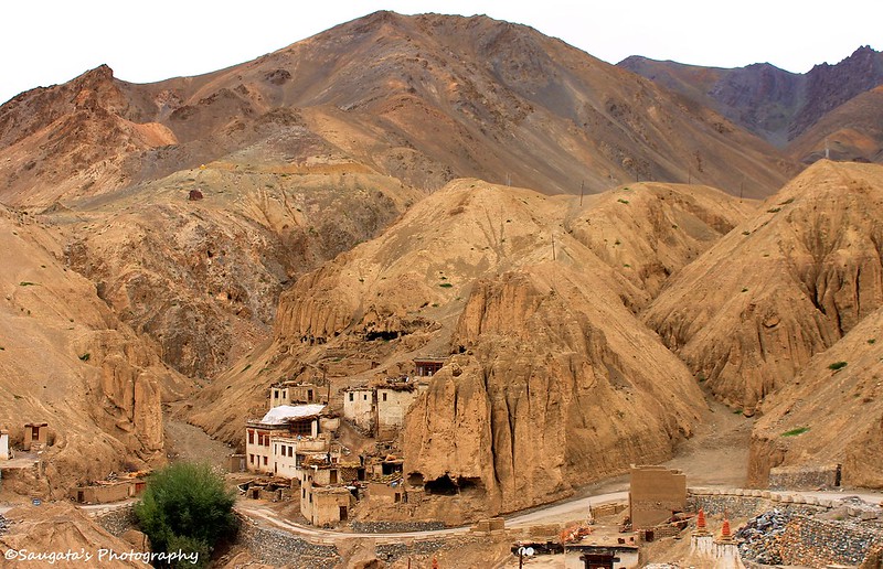
From Fotu La, the newly built tarmac led us to Lamayuru in no time, but yet it was 5 pm. The moment Lamayuru village and the gompa appreared at a distance, we were ecstatic as we have made this far in a day.
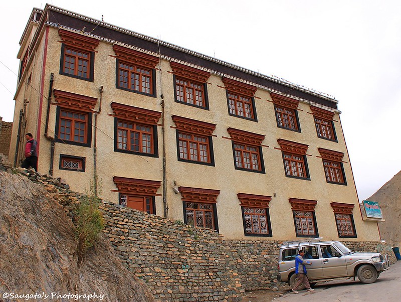
We easily found a cheap accommodation at the Niranjana Guest house with clean rooms and great view of the village below (common toilets). The guest house was situated just besides the Lamayuru monastery, and we were lured by the prospect that we could visit the Gompa in the evening and thus could start in the morning early.
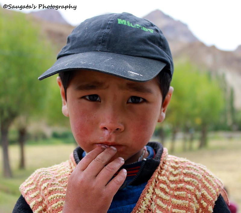
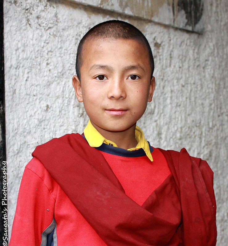
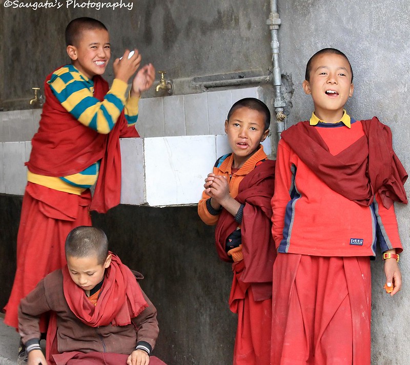
A cuppa hot tea recharged us quickly and we entered the premises of the Oldest Monastery of Ladakh (Lamayuru Gompa is founded in 12th or 13th century) within 5 minutes. The monastery was not in great shape, but the prize moment came when we identified a group of lama kids were playing together and they did not shy away from the camera.
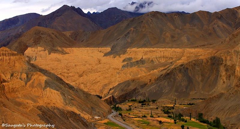
From the Gompa, the surroundings looked as someone had meticulously painted them as a whole with gorgeous colours which would never fade away. The village below was full of greenery as an oasis in the midst of the desert.
It was enough for us to call it a day after the tedious journey, so we returned back to our nest where we got freshened up, had our food (good food) in the dining hall, crashed into the bed and sank into a delicious slumber in no time.
 |
| Lamayuru and Gompa - the first sight |
 |
| The village |
 |
| Prayer at the Gompa |
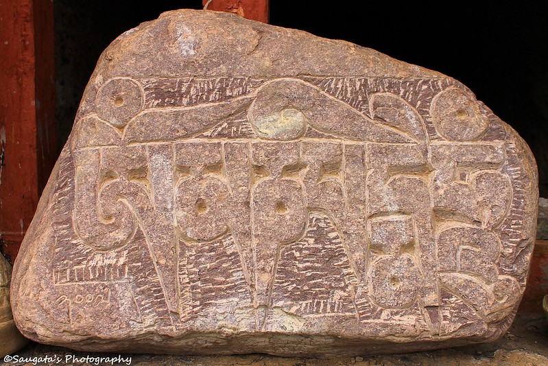 |
| Inscription |

 |
| Niranjana Guest House |
To Be Continued......
awesome photography...as if we can see every tit-n-bit of nature through your camera's lens...great pics..
ReplyDeleteThanks Debashree for going through the blog and appreciating it.
DeleteThis comment has been removed by the author.
DeleteHotels in Srinagar - Srinagar is considered as Jammu and Kashmir investment and this is also popular as Globe Heaven. Featuring the serene Dal Lake and the pristine snow-clad mountains of the Himalayas, Srinagar has been rightly dubbed "Venice of the east". Located on the bank of Jhelum River, the city is famous as the summer capital of India, and offers tourist delights like the Mughal Gardens, lakes, houseboats and handicrafts. - Srinagar Hotels
ReplyDeleteThanks for sharing such information. So enjoy its beauty in special offer of Srinagar Package at affordable cost.
ReplyDeleteNote: Today Book Your Package Get 20% OFF Call Us : 9911303818