Day 7, 14th September, 2012
Deskit > Agham > Tangyar > Wari La > Chang La > Sakti > Durbuk > Tangtse (195 KM)
Next morning we started as early as 7 am as advised by Rigzin earlier. The morning light was just starting to unfold itself with its full capacity. With the gentle sun and a mild breeze, the weather was too pleasant to enjoy.
 |
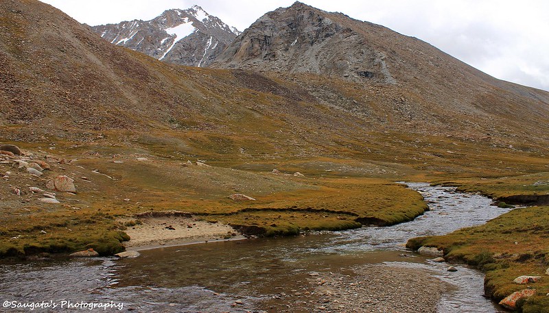
| Morning Rays and Reflection |
 |
| Leaving Nubra Behind |
Before we take the diversion towards Agham – Wari La route, we had a sumptuous breakfast at Khalsar. We also fully loaded ourselves with Paranthas, Pickles and Omelettes since the whole Agham-Wari La route is devoid of any place to have food.
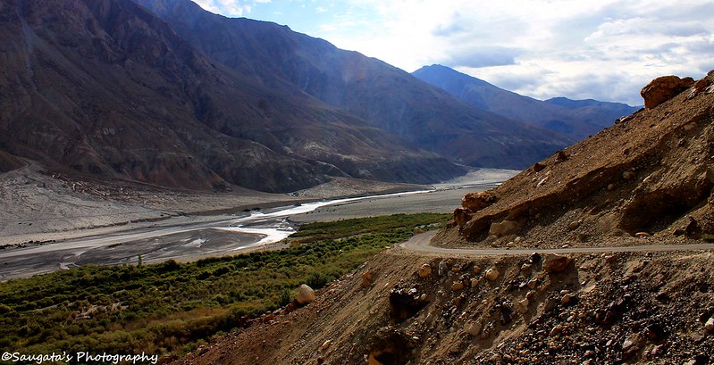
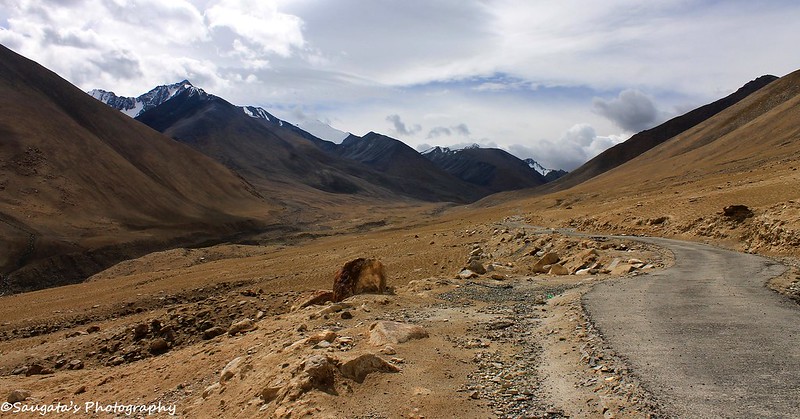
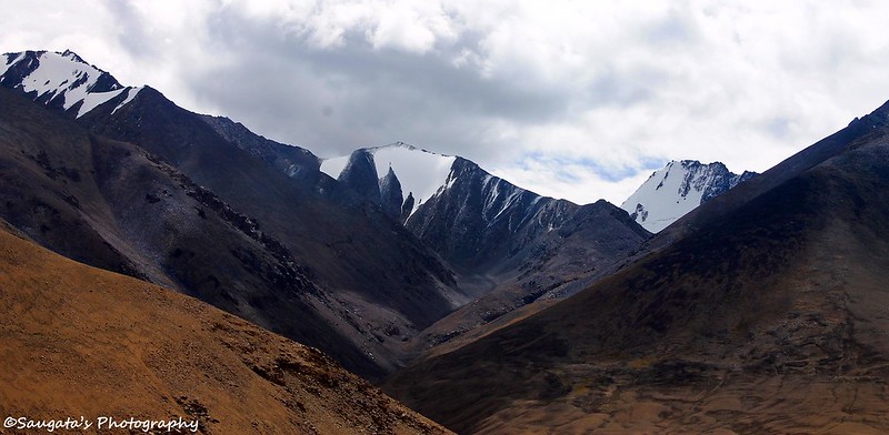
So the adventure began when we entered the route towards Wari La. Immediately after taking the diversion, it was evident that we had been in one of the remotest corners of Ladakh. There was no symbol of civilization could be seen apart from the tarred road as far as our eyes could reach, let alone any human being. The rugged mountains looked more barren due to the lack of vegetation while the only familiar sight was the gentle-flowing Shyok river. Snow-capped peaks were visible at a distance.
 |
| On the way the remoteness begins |
 |
| Familiar Vistas |
 |
| Shyok Valley and the Snowcapped peaks |
 |
| One who braved the nature |
We passed Agham village – though we could not locate where the village was – and crossed one small wooden bridge, after which the road was bifurcated into a couple of direction – one heading towards Wari La, our route, and the other headed towards Pangong through an even shorter route via the Shyok Village. We enquired Rigzin whether the idea to take that route was sensible. He advised not to, as the road was completely washed away.
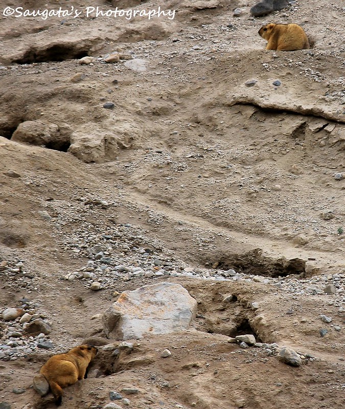
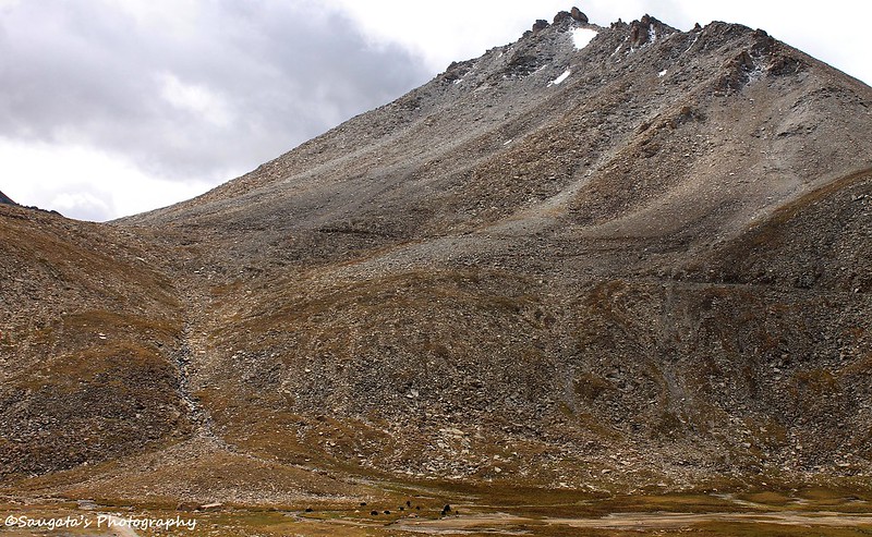
We passed the Tangyar village and then the ascent to Wari La started. In addition to the gorgeous vistas, we saw the Himalayan Marmots for the first time. The cute little fluffy creatures stay beneath the surface in small holes, and nearby a source of water.
 |
| We crossed many of such streams on our way |
 |
| Tangyar Village |
 |
| Himalayan Marmots - first look |
 |
| A closer look |
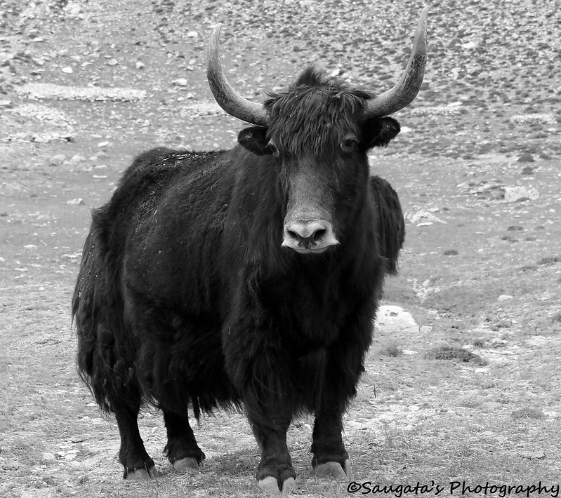
The ascent to Wari La was easy enough, but the remoteness of the location made it unique. We saw Yaks and Pashmina Goats grazing on the small valleys covered with patches of green. A small stream of an unknown river was flowing besides the road where we stopped in a faint hope to see some Marmots from a close distance, but couldn’t. The weather was immensely cold, but the picturesque backdrop was too panoramic to be missed.
 |
| Pashmina Goats |
 |
| Towards Wari La |
 |
| "Snowed Under" |
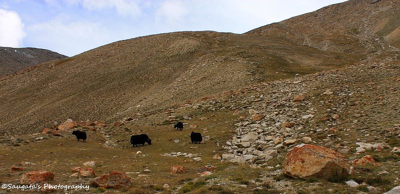 |
| Yaks Grazing |
 |
| They posed for us |
 |
| And so did this one |


We reached at Wari La top at around 12 noon. We had some Paranthas and rest we left to be had at the Chang La top. Wari La was once again so remote that no living soul could be seen around. Through this whole stretch towards Wari La, no other car overtook us from any direction.
 |
| Can you see the black dots? They are yaks - on the way to Wari La |
 |
| From Wari La top - the same yaks can be visible as tiniest black dots |
 |
| Wari La top |
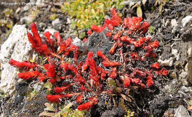 |
| Colorful Vegetation at W top |
While we were gradually descending from Wari La towards Sakti, Rigzin suddenly screamed “Who dekho Saab, lomdi (Look there, a Wild Fox)”. We could see a doglike creature running around (Rigzin said it was chasing a Marmot), but it was so far away that neither we could clearly see it nor we could take a clear snap (it was way outside my zoom lens’ reach!). We came to know that the sighting was very rare.
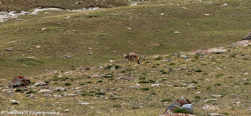 |
| Can you see the fox? |
 |
| A curious one |
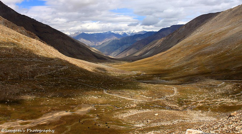
After some time, another ascent began towards Chang La. The weather wasn’t sunny any more it was cloudy and very small snowflake could be seen falling from above. They were too thin to form the white cover over the earth. The road too was not too bad, but there were many scary patches in between, especially at the final ascent towards the summit.
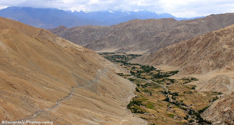 |
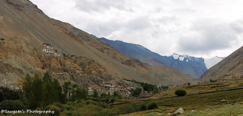
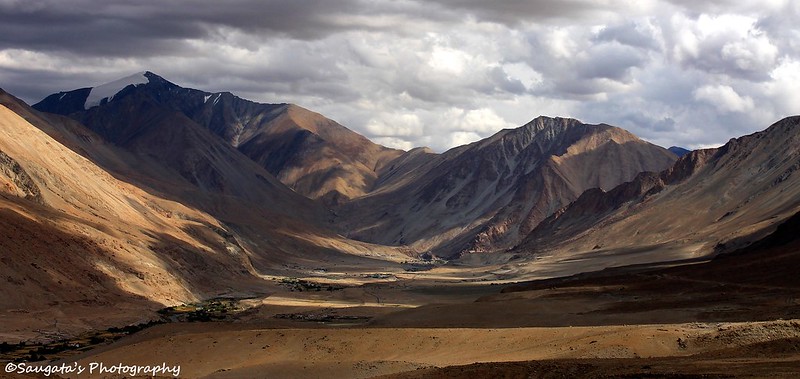
| Sakti Village as seen from on the way to C top |
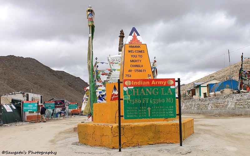
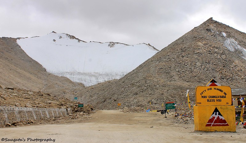
We reached the C-top around 2 pm, we were so hungry that we wasted no time to make the rest of the foods disappear in a flash. C-top is the 3rd highest motorable road as the board claimed which can be argued but the fact is that we were indeed at 17586 feet (5360 metre) above the sea level. It was windy and bone-chilling cold. Seeing the road ahead, we were in no doubt why it is called ‘the mighty Changla’. Ice and snow were plenty at the top of the peaks while there is a temple of ChangLa Baba at the top to shower blessings to those who cared to visit.
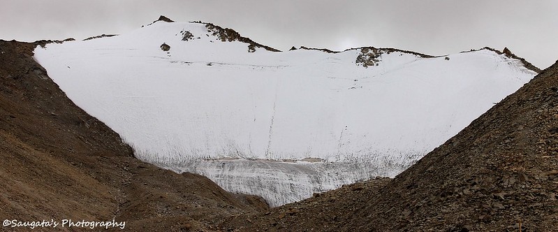 |
| Snow range so close |
 |
| C top |
 |
| Farewell to C- top |
Tangtse was just 35 kms from C-top, but it took us around 1.5 hours as the descent from chang la consumed a lot of time – the road was once tarred but then was only full of gravel, frequent wheel-spin funs (?) were enough to send a chill through the spine.
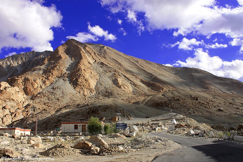
However we survived and reached Durbuk where we had some tea and Rigzin searched for Diesel in vain. We reached Tangtse at around 4.30 pm which is a small village but had good but limited accommodation options. We stayed at the Chang La Guest House, which would get 10 on 10 given the hostile surroundings. Excellent food and hot water, clean rooms and great views from the rooms recharged us quickly. We even strolled across the road for some time!
 |
| The way ahead from C top |
 |
| Chang La Guest House - where we stayed |
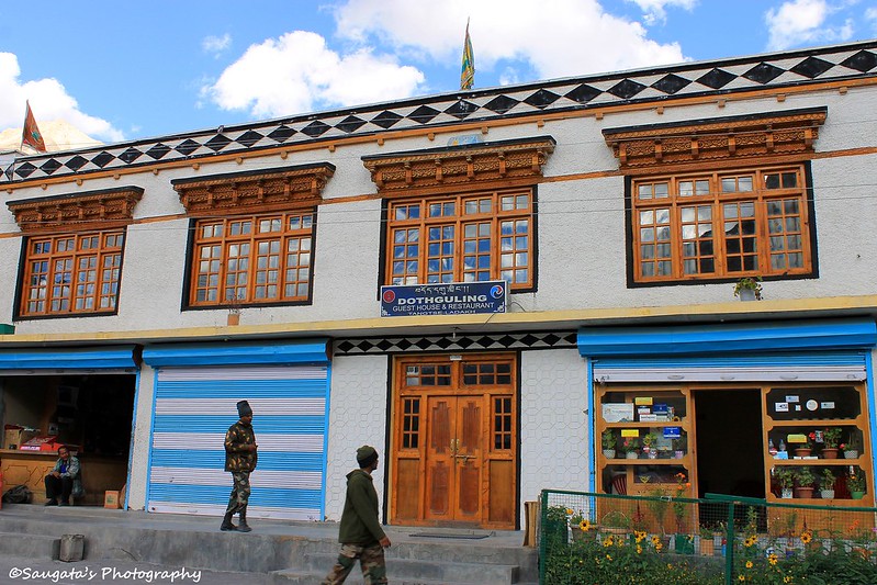 |
| Dothguling Guest House - where the 3-Idiots shooting team stayed |
 |
| On the way towards Pangong Tso |
The next day our destination was the fabulous Pangong Tso and the journey was also very less – around 2 hours only so we thought to save most of the energy for Pangong.
No comments:
Post a Comment